adventure2014 / Canyon Adventure
November 20, 2014


November, 2014: The Canyon Adventure
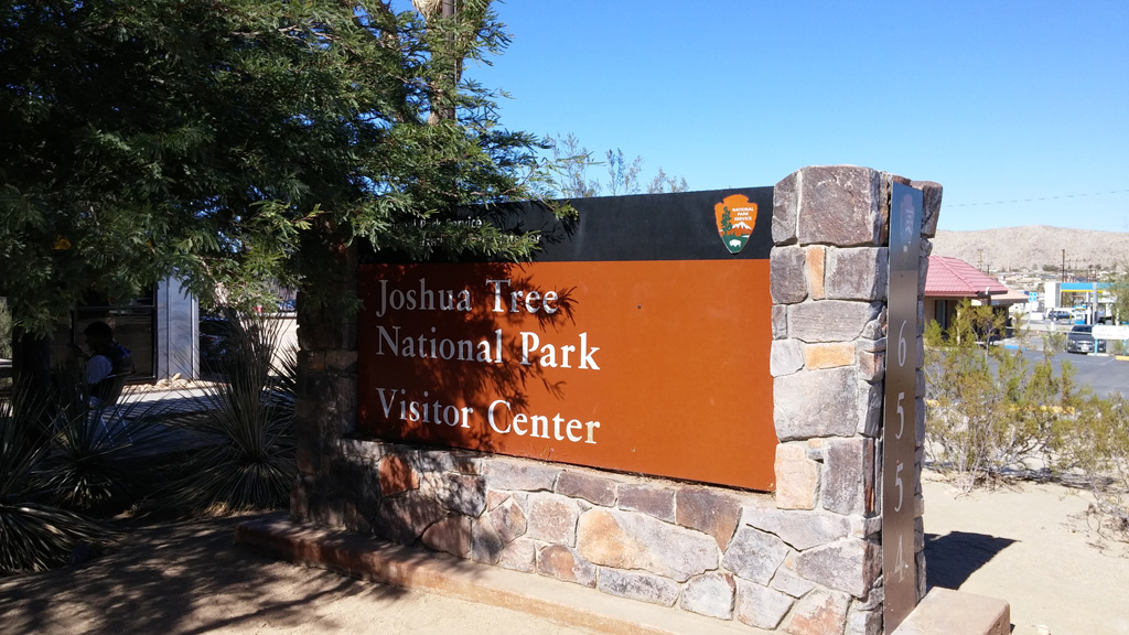
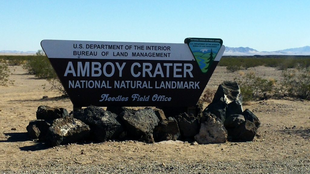
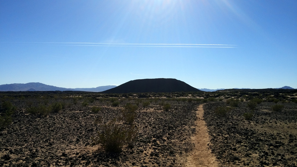
We decided to do a big road trip of various state and national parks including quite a few canyons. The whole trip would consist of the following stops: Joshua Tree NP, California; Amboy Crater, California; Grand Canyon NP, Arizona; Glen Canyon NRA, Arizona; Coral Pink Sand Dunes SP, Utah; Bryce Canyon NP, Utah; Grand Staircase-Escalante NM, Utah; Capitol Reef NP, Utah; Otter Creek SP, Utah; Zion NP, Utah; and finally, Lake Mead NRA, Nevada. In total, the trip was 1777 road miles, and included over 20 miles of hiking and biking.Day 1: We started our adventure with a leisurely drive out of the San Gabriel valley toward our first destination, Joshua Tree National Park. Although we didn't plan on staying long, as we had been here before, we figured it was on the way and we might as well stop by. We visited the Visitor Center and took a few snapshots of the area before heading up Amboy Road to our planned first destination, Amboy Crater. We arrived around noon and ate our lunch on a picnic bench near the parking lot before heading out on a 3 mile round-trip hike. Although it was November, it was still 85 degrees out in the desert where this crater is. It was a good start to our trip, and a nice hike for those looking for an easy walk with a fairly strenuous last section up into the crater. After our successful hike, we headed towards Kingman, AZ for dinner at the Cracker Barrel before ultimately arriving in Tusayan, Arizona, just outside the Grand Canyon.
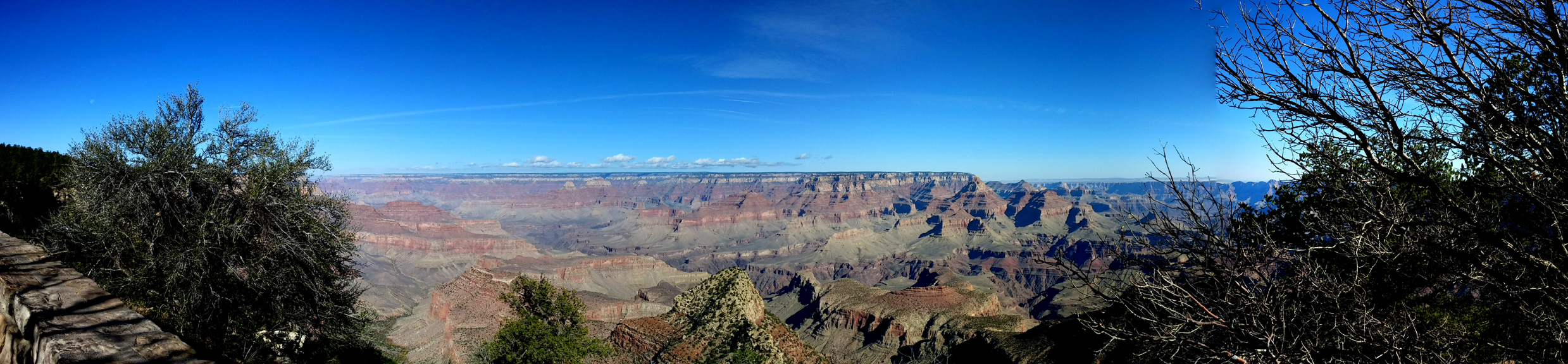
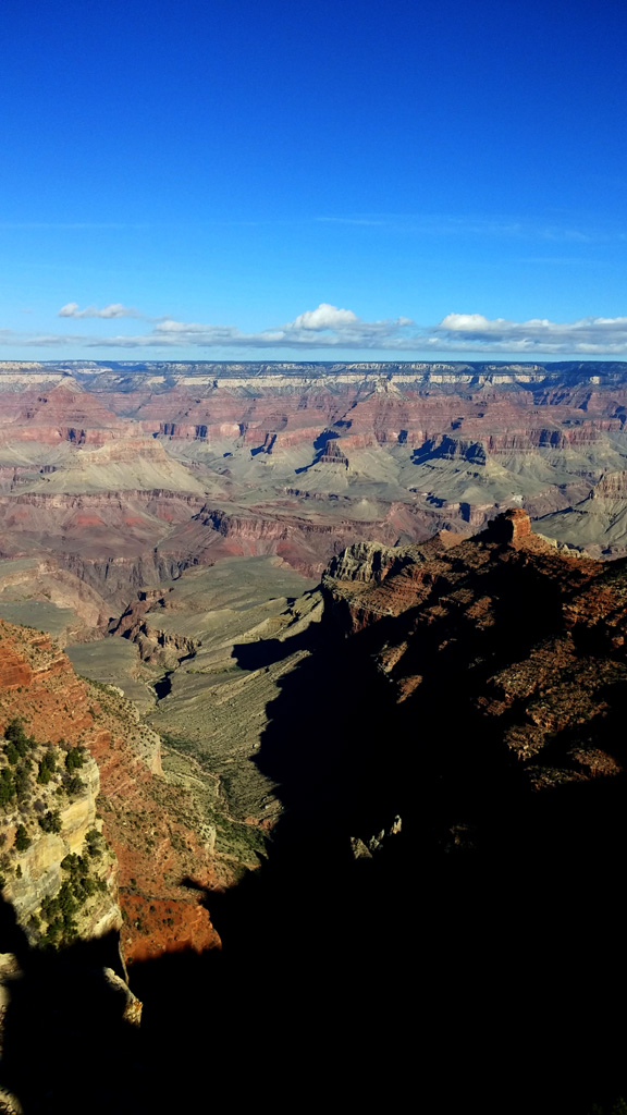
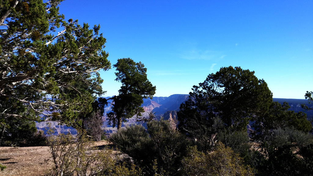
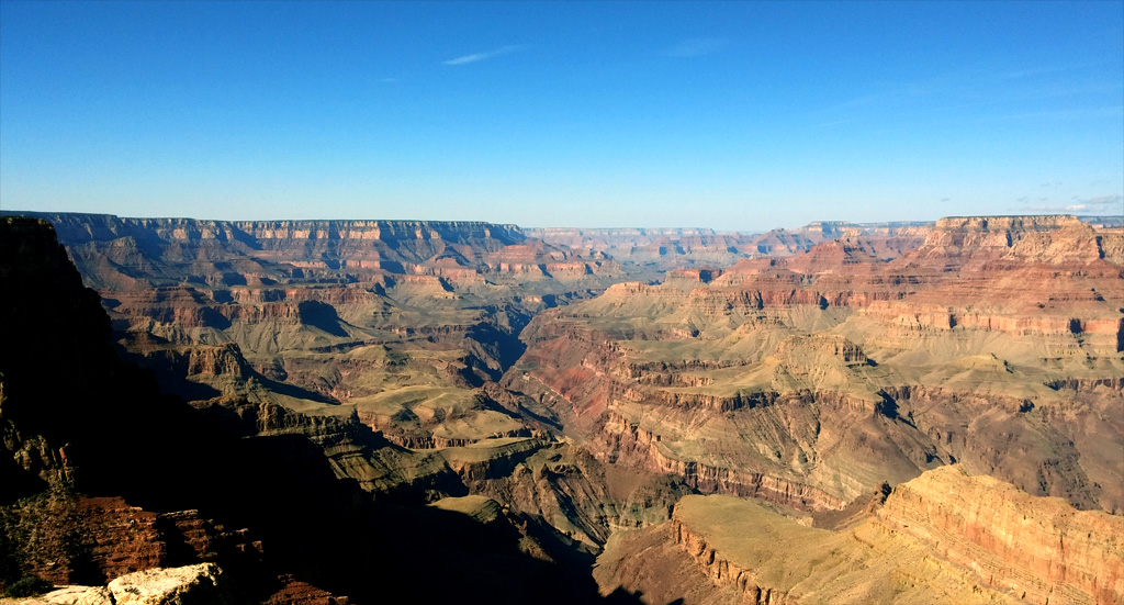
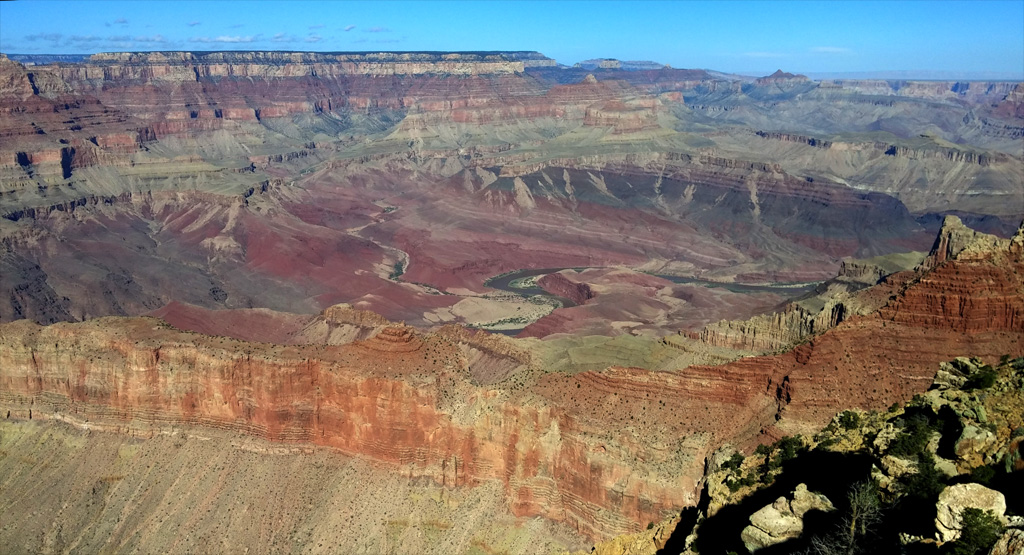
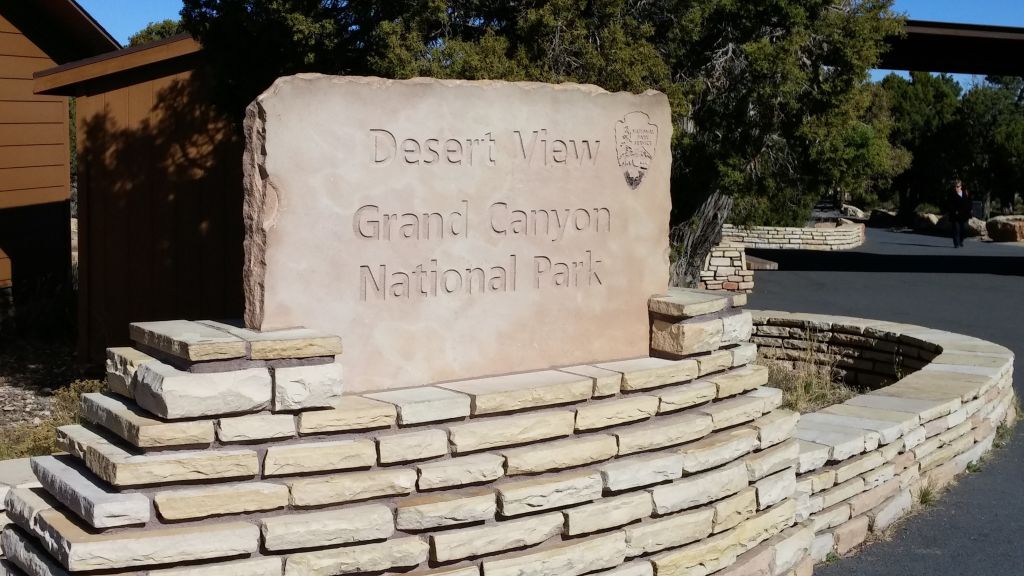
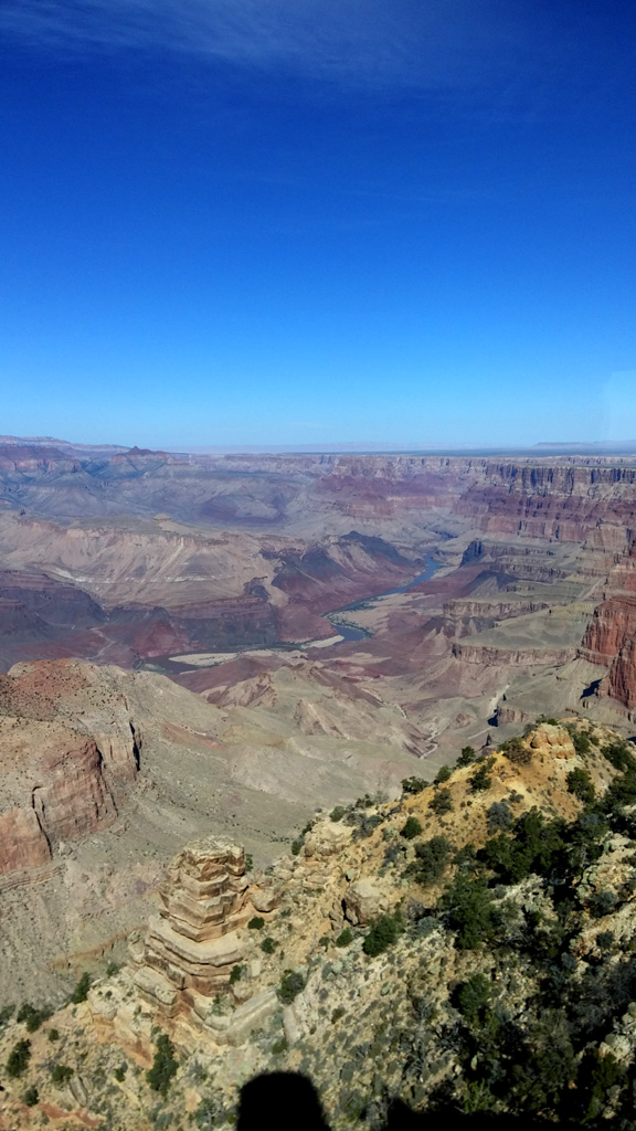
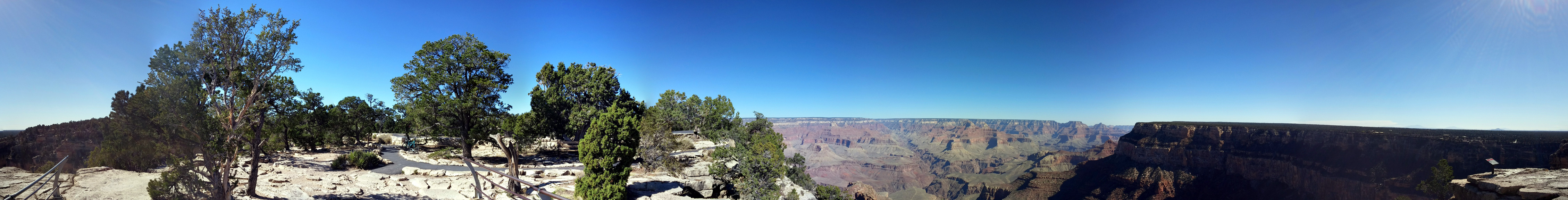
Day 2: We woke to what we thought was a chilly morning, ready for a day of hiking and biking. The original plan was to ride our bikes along the Hermit's Road and then catch a shuttle back to Grand Canyon Village. About 2 miles in to the ride, we determined that the distance + altitude was too much to handle for us and turned around. After storing the bikes in the truck, we headed back out to Hermit's Rest via the shuttle system, enjoying many beautiful views of the canyon from the south rim. After visiting the various touristy places in the village, we headed back to Tusayan to eat dinner and get some rest. We ate some pretty good pizza at a place called "We Cook Pizza and Pasta."
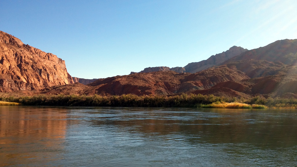
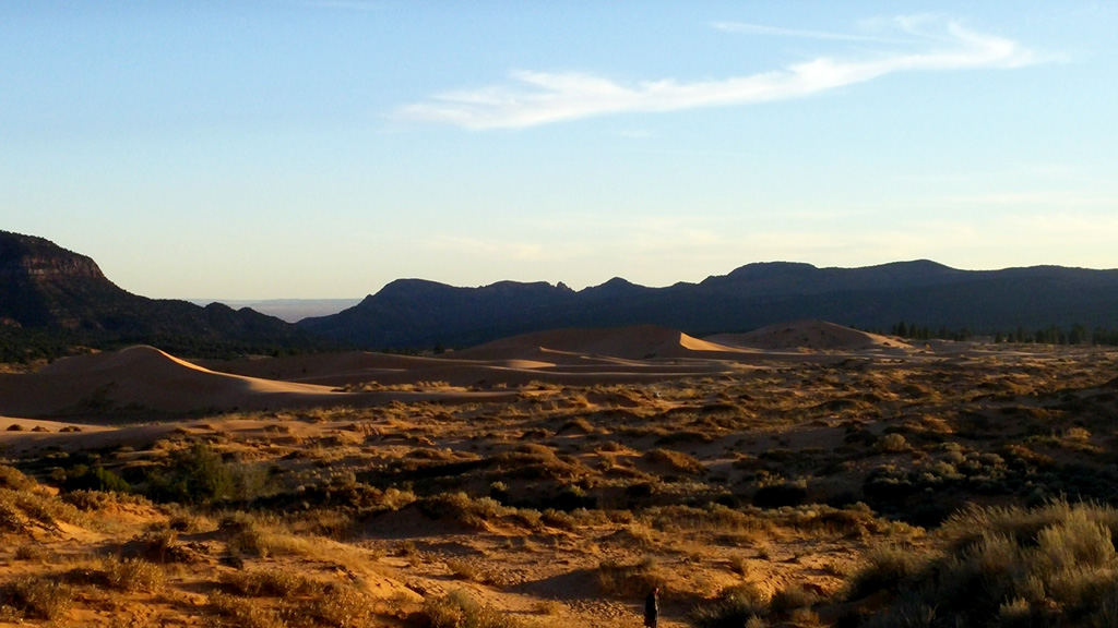
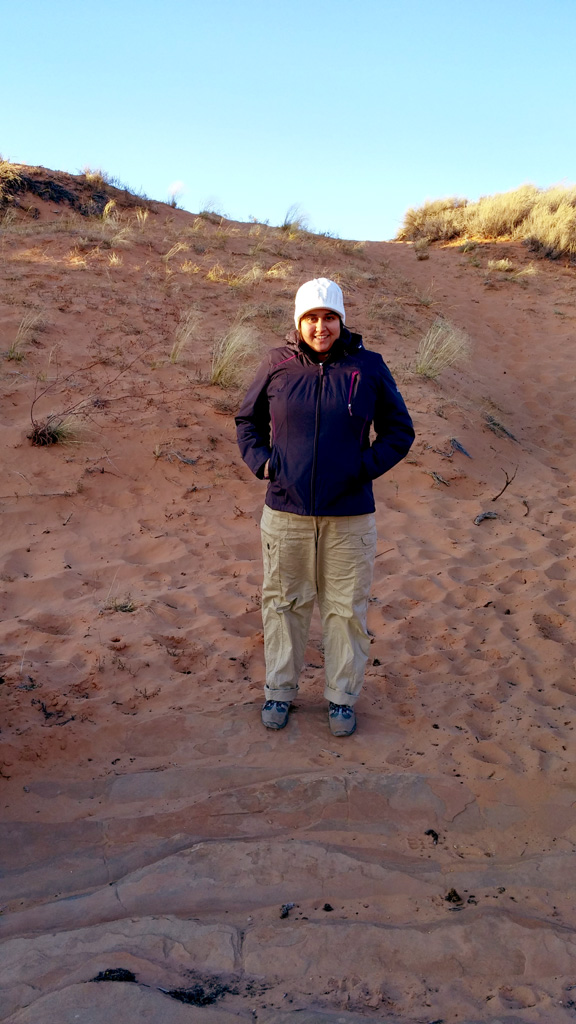
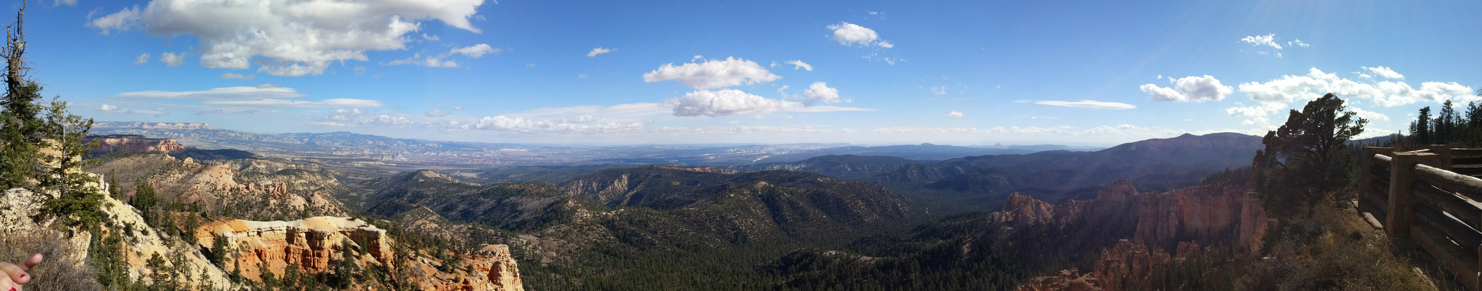
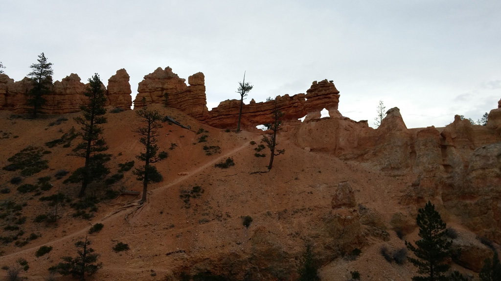
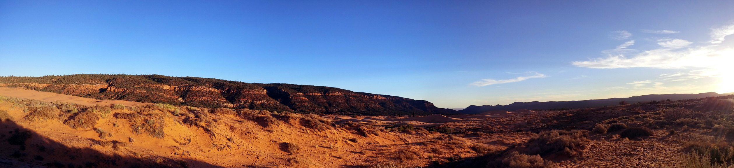
Day 3: The third day was a driving day. We started off from Tusayan pretty early and headed west towards US 89A and Lees Ferry, at the southern end of Glen Canyon NRA. I had never been to this part of GCNRA before, and it was pretty amazing. We saw some folks preparing for a journey down the Colorado in a few rafts, which I imagine is quite chilly at this time of year. After taking in the views, we headed toward Utah along US 89A, which took us up past the forested North Rim of the Grand Canyon. We did not stop at the North Rim, as we feared the roads may be closed, and traveled on to Coral Pink Sand Dunes State Park, just north of Kanab, Utah. It had been probably 15 or more years since I've seen the pink dunes, and it they were as amazing as ever. Due to our late arrival, the sun was setting and the dunes were looking gorgeous in the fading light. We finished the day by driving north through Red Canyon and into Bryce City, where we stayed the Ruby's Inn.
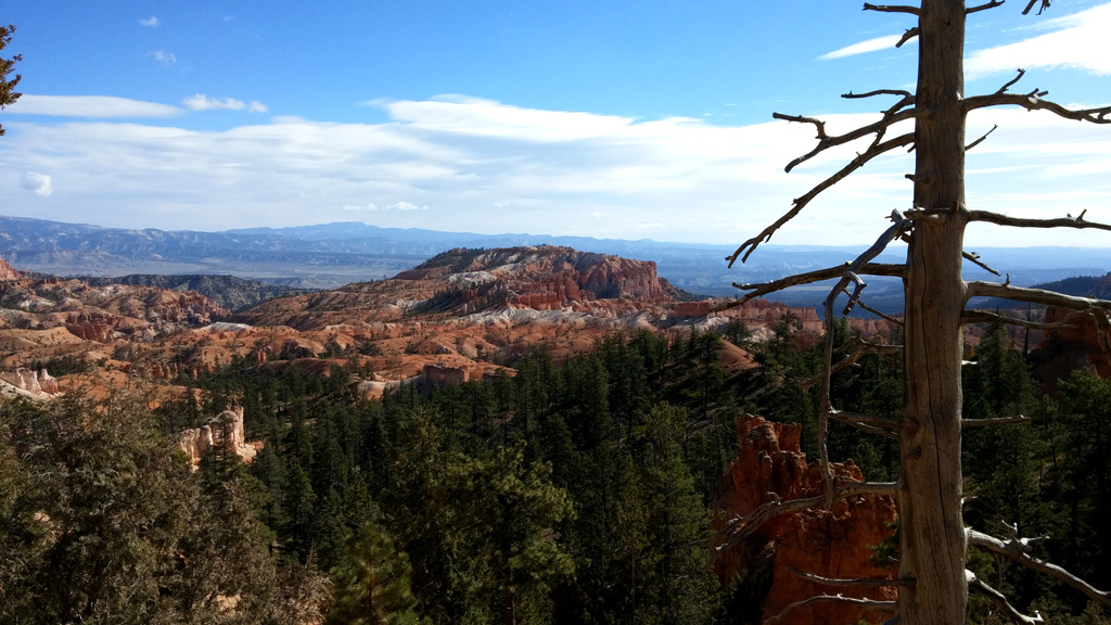
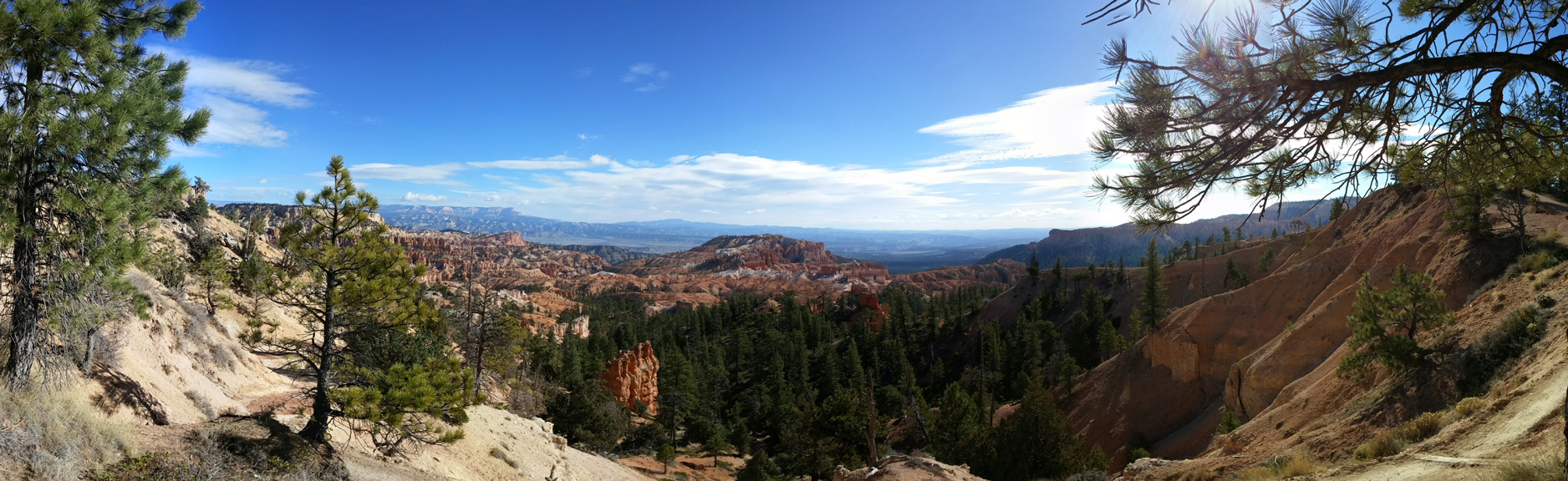
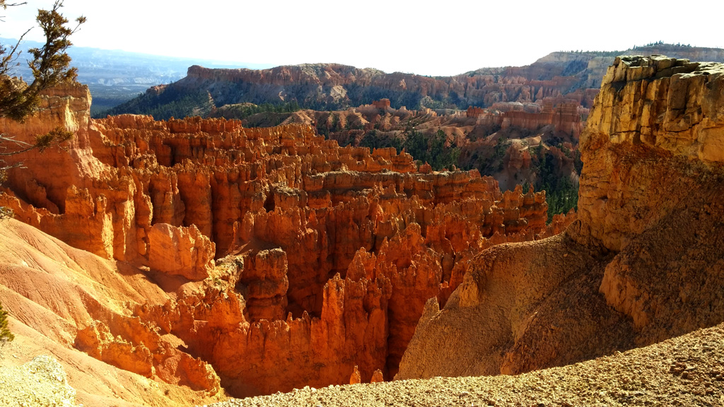
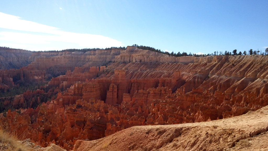
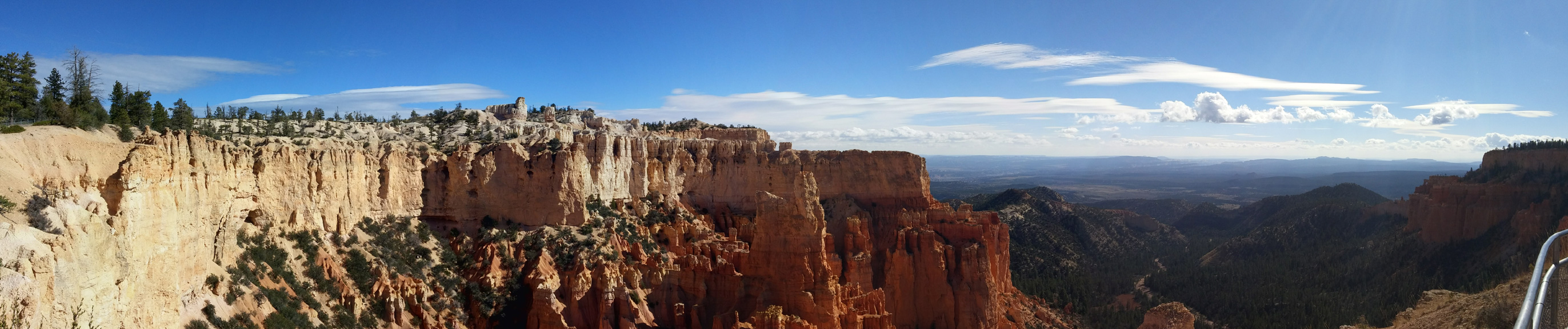
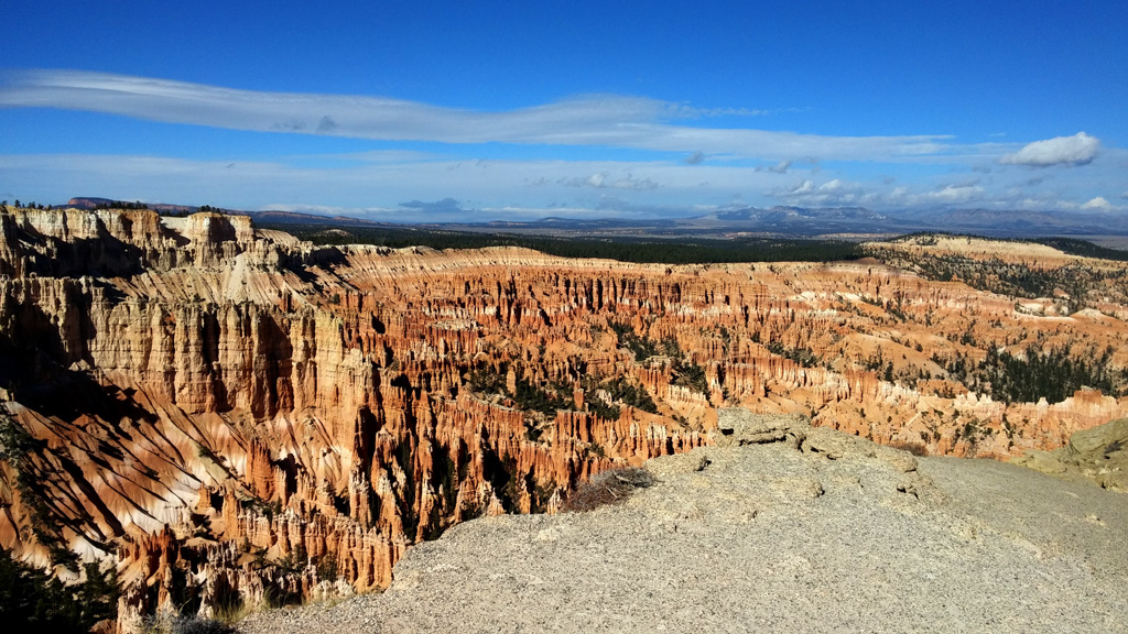
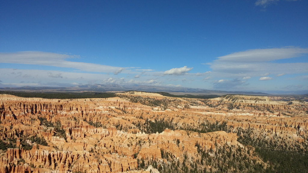
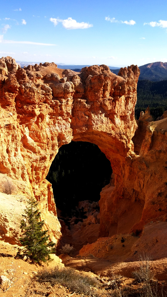
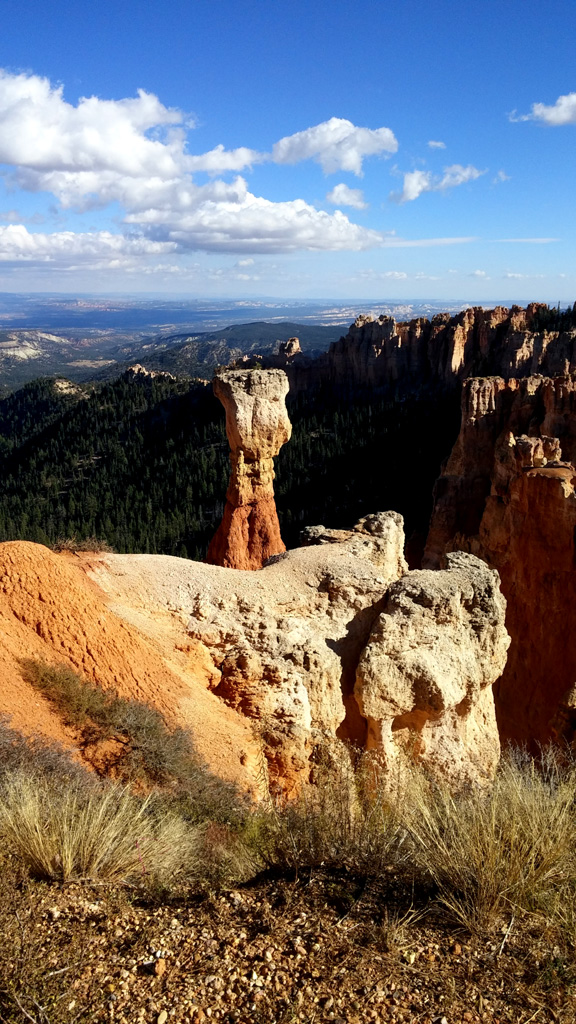
Day 4: We awoke to some very chilly weather. It made the Grand Canyon feel balmy in comparison. Since Bryce Canyon is at such a high altitude, we made sure to dress in extra warm clothing. We visited all the normal view points, and tried our best to get away from the crowded northern section where all the tour buses are allowed to travel. We took a few short hikes, just below the rim of the "canyon" before heading back to town. Most of the restaurants were closed for the winter, and we ended up eating dinner at Subway.
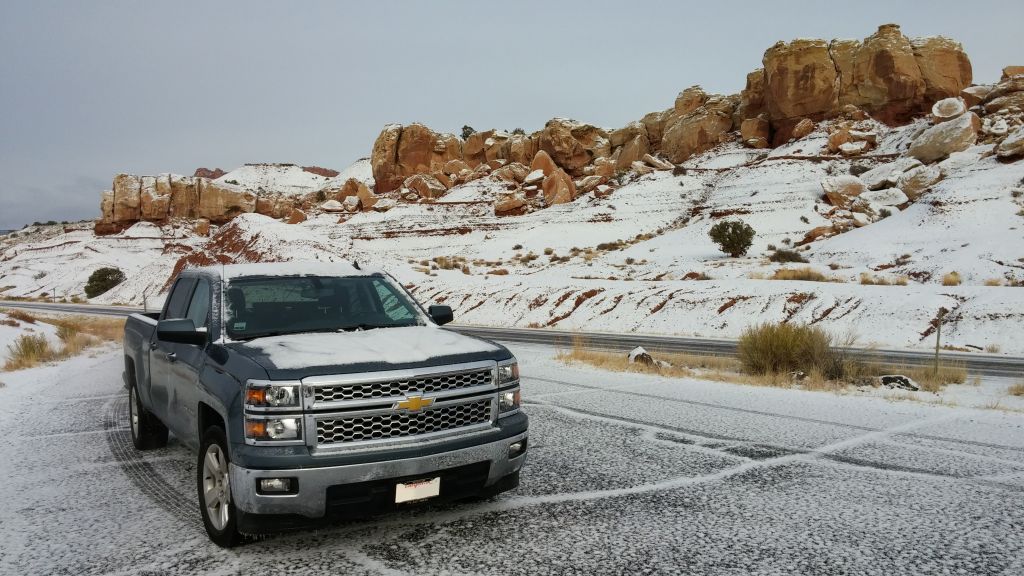
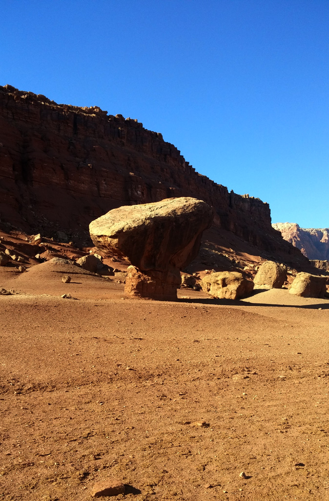
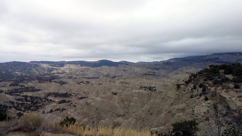
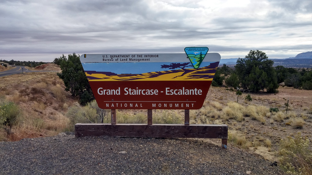
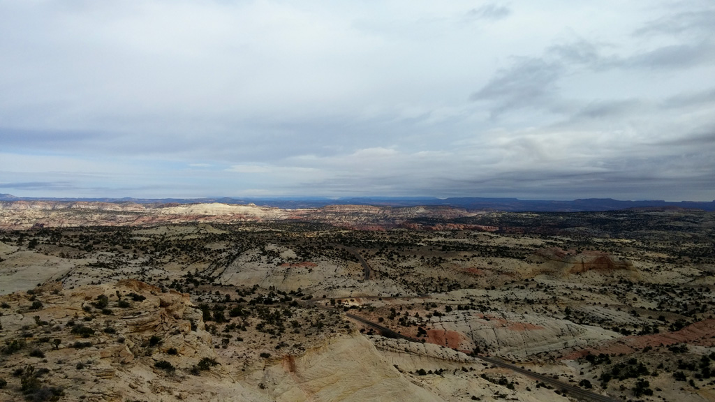
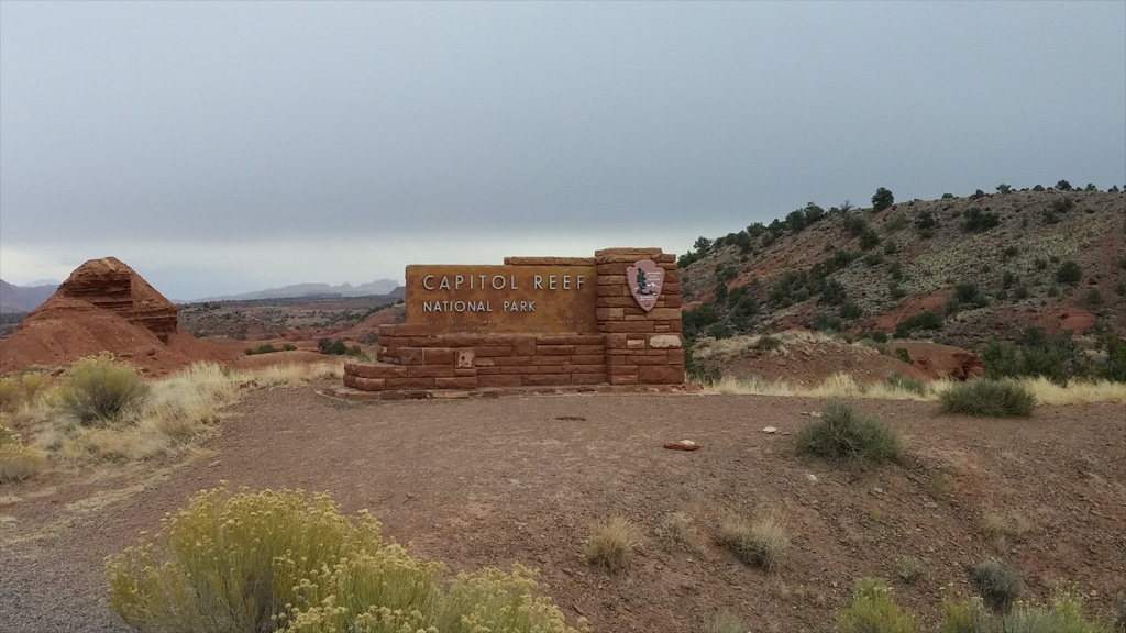
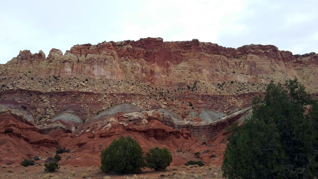
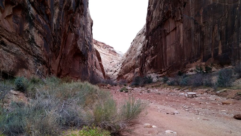
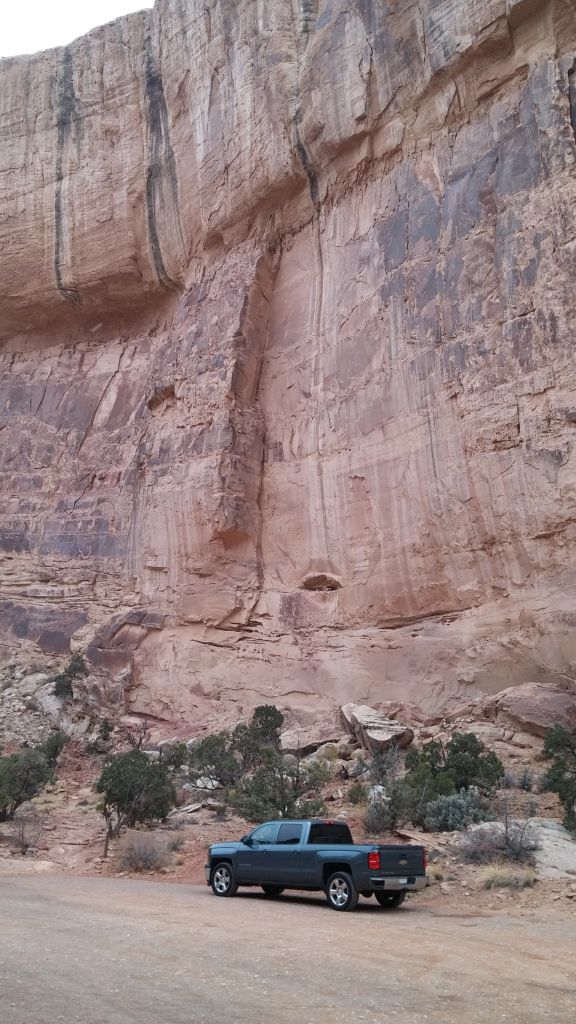
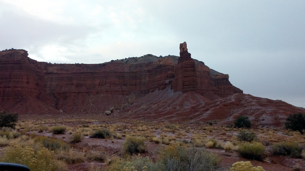
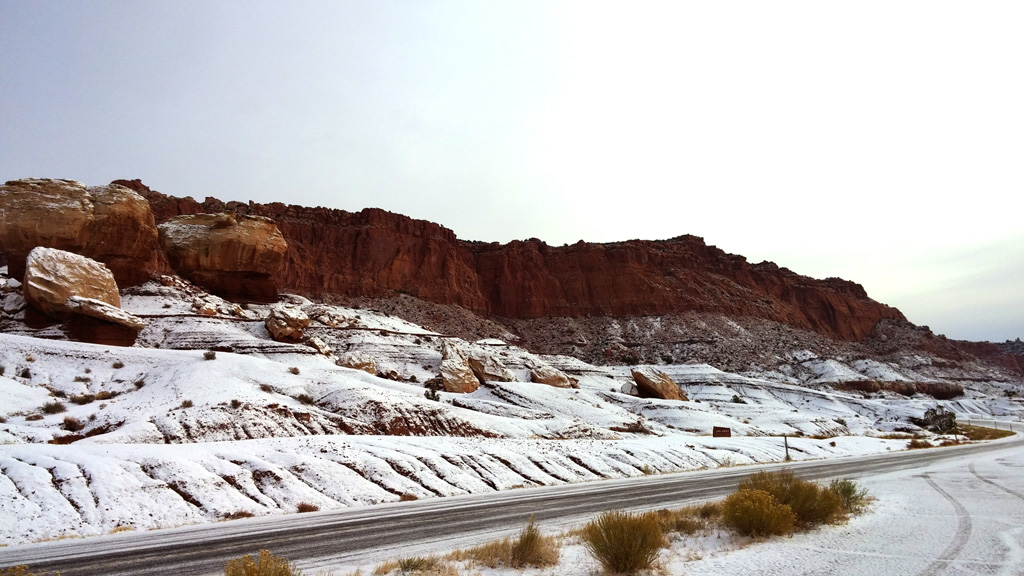
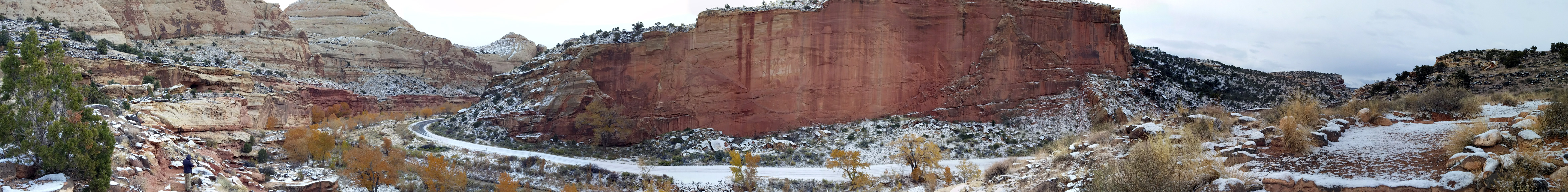
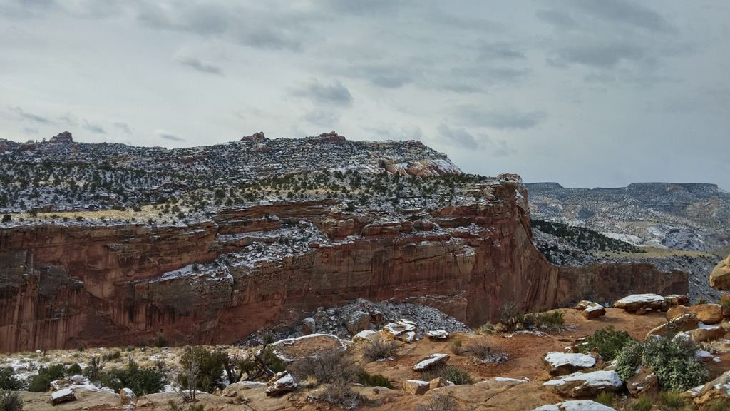
Day 5: This was another driving day. The plan was to drive up State Route 12 to Torrey for our visit to Capitol Reef. We encountered a bonus on this route, as it took us right through the awe inspiring Grand Staircase-Escalante National Monument. We stopped in the visitor center and learned a lot of new things about this area. It's amazing how much area in the western United States is public land. On the way over the mountains near Boulder, Utah, it started to snow. We reached our highest point on this leg of the journey, at somewhere over 9000 feet of elevation. We got to Capitol Reef with enough daylight to enjoy the Scenic Drive and even entered Capitol Gorge for a quick walk. It was very cold, and the weather was threatening, so we decided not to chance walking down the wash. We headed back into Torrey for a meal at the Red Cliff Restaurant, which consisted of some scrumptious bacon burgers and fries. We retired to our hotel for the night, prepared for a long day in the morning.
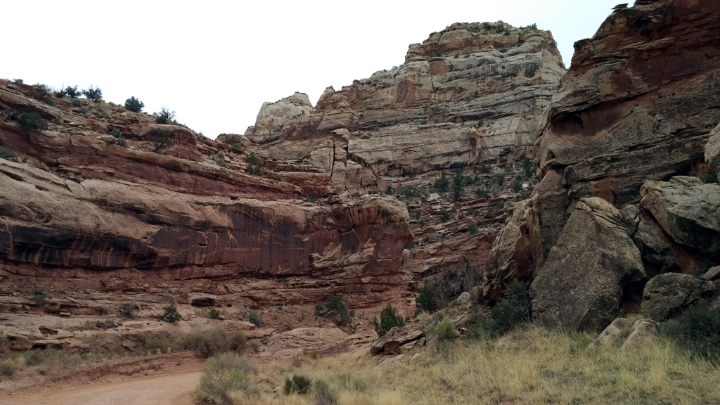
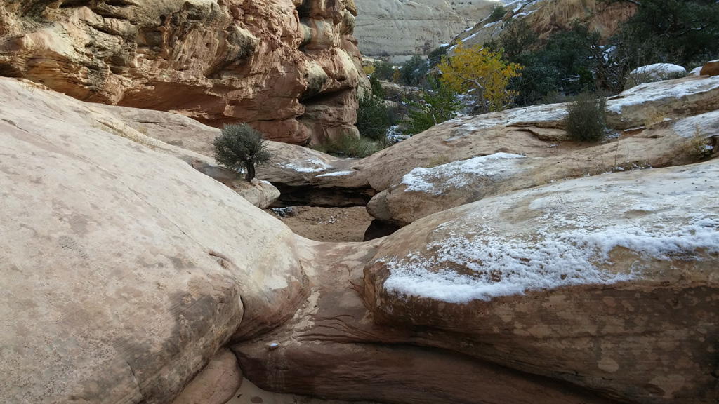
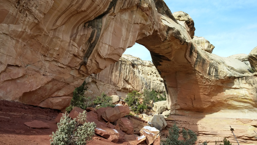
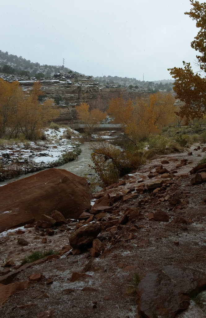
Day 6: Since we did not get to hike much in Capitol Reef, we decided we'd spend more time here than planned, since it was all new to both Alex and myself. We rose early to hike up to Hickman Natural Bridge, which was awesome. It's actually not a bridge at all, but an arch. The only other bridge I've seen like it is Rainbow Bridge, but you aren't allowed to go near it. The trail for Hickman NB actually takes you right underneath, which supplies plenty of opportunity for great photos. The trail also takes you along the Fremont River. Toward the end of the hike, it started to snow, but it soon turned to rain. The rain didn't last long, and blue skies were on the horizon, so we headed back down the scenic drive to Capitol Gorge. We hiked to "the tanks" and the pioneer register, getting some great shots along the way. We went back to the Red Cliff for lunch as we headed west, on our way to Zion.
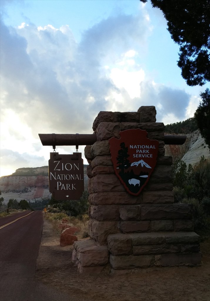
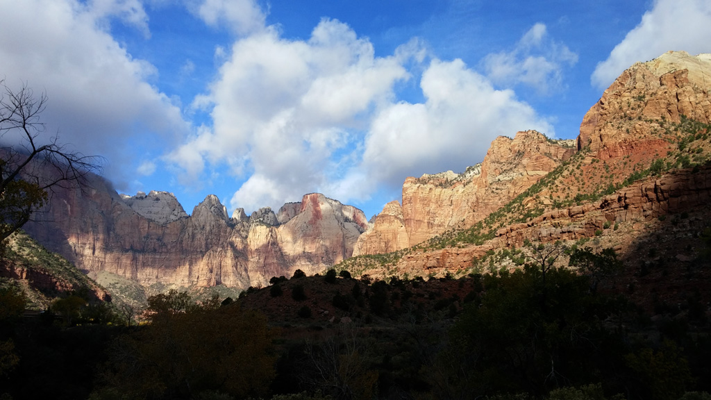
We took an alternate route, along SR24 to SR62 where we encountered some rather stormy weather. I wanted to stop by Otter Creek State Park, but since the rain/ice was coming down so hard, we just drove by. Maybe next time I'll get to visit the area and see some otters in their natural habitat. We eventually met up with US 89 again and drove through various quaint looking small towns on the way to Zion. We arrived at the eastern entrance to the park a little before sunset, so we were able to see things like Checkboard Mesa and traversed the tunnel while there was still daylight outside. We checked into our hotel, had a bite to eat at the hotel's restaurant, and went to bed. It was a long day, and we were both pretty tired.
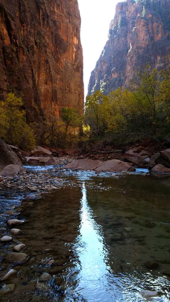
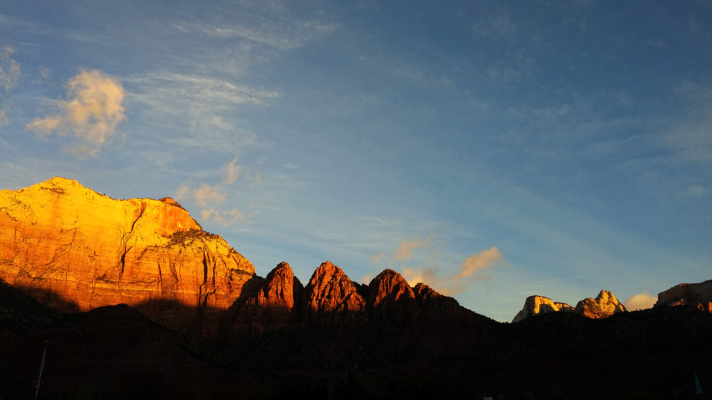
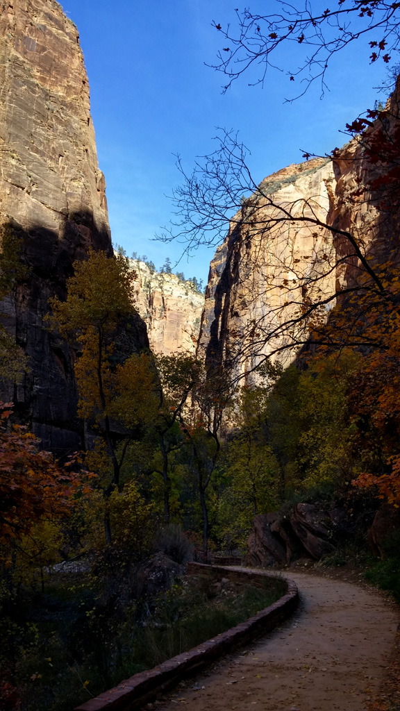
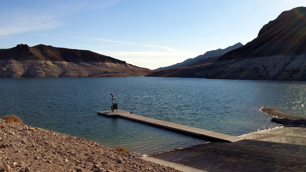
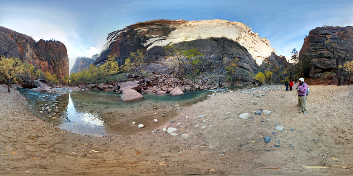
Day 7: On our final day, we headed back into Zion for a short bike ride along the Pa'rus trail. Due to being in the back of the truck for five days or so, the bikes were exhibiting some issues that I hadn't planned on and didn't feel like fixing. We cut the ride short and headed back to the Visitor Center, where we caught a shuttle to the Temple of Sinawava. We walked the length of the Riverside trail before taking the shuttle back to the truck for the drive home. Along the way, I chose to leave I-15 for SR169 in Nevada, which took us along the Overton Arm of Lake Mead. We stopped by Echo and Callville Bays to view for ourselves how low the water really was in the lake. It's incredible to see, where there used to be a launch ramp, it's now a parking lot over 100ft above where the water level is currently. I hope that we will see a few good, wet years in the southwest and our reservoirs will start filling up again. I naively look forward to a day when both Lake Powell and Lake Mead are at once again at, or near full pool.
I took Lakeshore Road all the way into Boulder City, and then traveled through Henderson before meeting back up with I-15 for the long, boring ride home. Somewhere just past Baker, the wind picked up, and we faced a strong headwind all the way into Victorville. We fought the traffic going over Cajon pass in some dense fog and made it home by late evening.
All in all, it was a very fun trip. It was great to see places I've been before as well as experience places new to both Alex and myself. I thoroughly enjoyed the entire trip, and look forward to planning our next big adventure.